The Fleet
NDAA-compliant airframe with survey-grade LiDAR. Single-platform operation, ROCK ecosystem end-to-end.
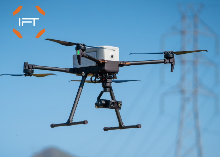
Inspired Flight IF800 Tomcat
NDAA / Blue UAS authorized heavy-lift airframe. Designed for survey and mapping with payload capacity for ROCK Ultra and similar sensors. Rigid carbon-fiber construction; Inspired Care Pro service plan included.
Blue UAS~4 kg payload30+ min flightHerelink controller
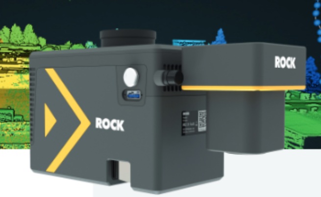
ROCK Ultra LiDAR + 45MP
Survey-grade airborne LiDAR with integrated 45 MP aerial metric camera. Class 1 laser, multi-return ground penetration, survey-grade IMU and tri-band GNSS. ROCK Desktop PPK and ROCK Cloud workflow.
1000m range7+ returns2-3 cm accuracy45 MP camera